
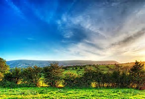
DISCOVER ENGLAND AND WALES
Michaelchurch Escley is the perfect location from which to discover the best of Wales and England.
Located on the edge of the Brecon Beacons National Park close to the borders of Herefordshire, Monmouth and Powys.
prev
next
THINGS TO DO
COURSES
ACTIVITIES
CASTELS
A COUPLE OF LOCAL WALKS
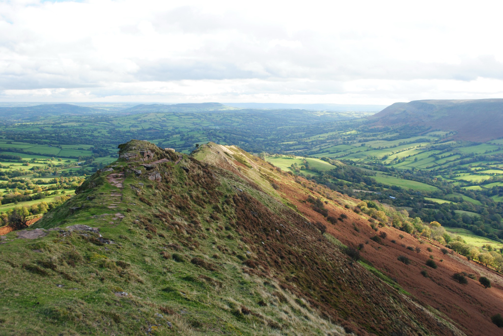
THE CAT’S BACK
A stunningly scenic walk through countryside made famous by Bruce Chatwin’s book, “On the Black Hill”. Allow about 3 hours.
DISTANCE – 8kms (5 miles)
HEIGHT GAIN – 300 metres (1000 feet).
START POINT – Parking area and picnic spot, signposted off narrow lane from Llanveynoe.
GRID REFERENCE – SO/288328.
MAPS – OS Explorer OL13. OS Landranger 161.
The optional extension to the summit of Hay Bluff adds a further 5kms (3 miles) but only a small amount of additional ascent – allow an extra hour.
The optional extension to the summit of Hay Bluff adds a further 5kms (3 miles) but only a small amount of additional ascent – allow an extra hour.
DESCRIPTION:
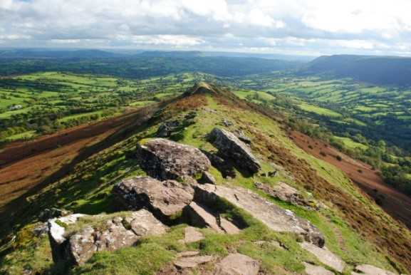
A reasonably straightforward yet superbly scenic walk up the surprisingly narrow ridge known locally as the Cat’s Back – returning through a lonely valley. The ridge is exposed, so it can be windy here, and you will need good hill clothing if the weather turns nasty. It is advisable to wear sturdy footwear – preferably walking boots – as there are a couple of rough, rocky sections, particularly on the descent.
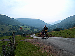
GETTING THERE BY CAR:
From the Bridge Inn, Michaelchurch Escley Turn left on the ‘main’ road towards longtown, take the first turn right, follow the road ahead and head straight over the staggered crossroads, at the ‘T’ junction turn right next to corner cottage, then turn right at the sign post of the picnic bench along a narrow road heading north-west into the Olchon Valley, then bear right to reach the signposted picnic area, which is shown on OS maps.
ROUTE:
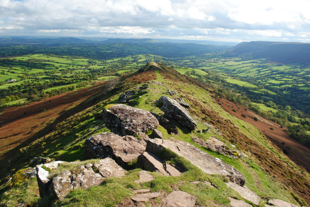
From the parking area, an obvious path heads straight up the steep slopes that mark the start of Crib y Garth! Although this is a rude awakening, it is not as bad as it looks, and the angle soon relents. Keep as close as possible to the centre of the narrow ridge to enjoy increasingly panoramic views, and don’t forget to stop and look back every once in a while. The route is obvious throughout this section, climbing in rocky steps, and quite unlike anything else in the National Park.
Part way along the ridge, just when it becomes obvious that most of the climbing is over, an old quarry to the right of the path makes an excellent sheltered spot for a break. On a clear day you can see the Malverns, and the Bristol Channel.
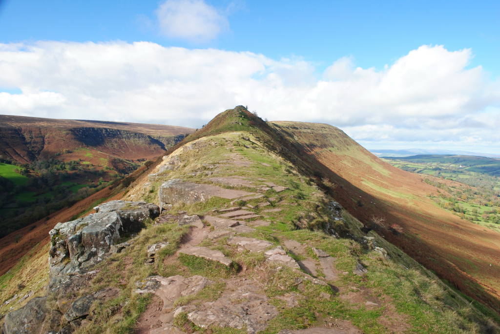
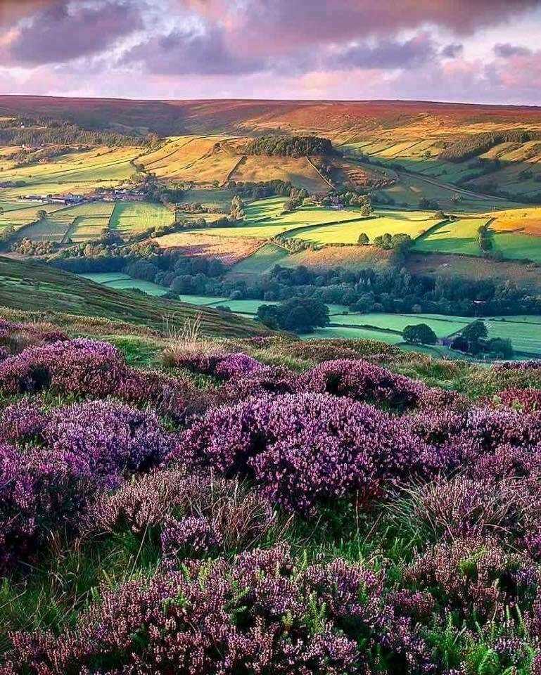
Beyond the quarry, the ridge soon loses itself in the main bulk of the mountain, and the path continues across a heathery plateau to reach the trig point which marks the top of the Black Hill. This section can be muddy after wet weather, but the worst is always easily avoidable. Continue along the path which skirts to the left of the dewponds, until you reach another path coming in from the large valley to the left.
Although this is your onward route, you can, if you like, extend the walk by following the top path for a further 2½ kms to reach Hay Bluff (marked by another trig point) – another fine viewpoint. If you decide to do this, keep to the path along the top of the ridge, and ignore the obvious flagged path that bears off to the right. Return to the junction by retracing your steps.
Back at the junction, follow the path into the narrow valley, soon passing the ruins of a shepherd’s shelter on the right and starting to descend more steeply. You soon get a good view of your onward route along the left side of the valley, shortly after which the path becomes steep, rocky and awkward for a short section before easing onto the more gentle slopes beyond.
Continue along the main track, eventually walking alongside a fence with the noise of a waterfall to your right. The track soon enters a wooded section, then ends at a metalled lane. Turn left, and follow the quiet lane through the Olchon Valley, passing several ruins – evidence that the valley was once more heavily populated than it is today. After about 2 kms, you reach the lane leading to the car parking area. Turn left, and follow this uphill to reach your car. Pop to the Bridge Inn Michaelchurch Escley for a well-earned drink and perhaps a bite to eat.
The Pub Lane and Escley Brook
A short easy scenic walk from The Bridge Inn though farmland and across the Escley brook. Allow about 40 minutes.
DISTANCE – 3.2kms (2 miles)
START POINT – The Bridge Inn – Michachaelchuch Escley.
MAPS – OS Explorer OL13. OS Landranger 161.
DESCRIPTION:
A easy circular walk along a foot path through farmland from the door of the pub.Giving stunning views across as the Cat’s Back down to the Escley brook and though a pretty orchard– returning via the road to the pub. The track and field can be a bit wet.
ROUTE:
From the pub head up the green narrow lane which runs up alongside to the left of the car park, follow the lane to the end and in the field at the end head right following the signed foot path down towards the Escley brook.This part offers great views of the cat back and the Black mountains.Locals say if you can’t see the cats back its raining, and if you can see it, it’s going to rain!
Once you cross the foot bridge head up the orchard and at the road turn right and follow the road back down the church and Bridge farmhouse.Turn right back down to the pub.
Now it’s time for a well-earned pint and maybe a Huffer – which is basically a hearty door stop sandwich.If your driving why not sample a local apple juice from Gwatkin – who make cider just down the road in Abbey Dore.